
Elevation & Maps
Course maps and elevation
Nature trails through the Wang Mi community forest in Wang Nam Khiao, with water stations and first-aid posts marked.
All three distances on one topographic map
Last updated 2026Mini Trail (the challenging natural route)
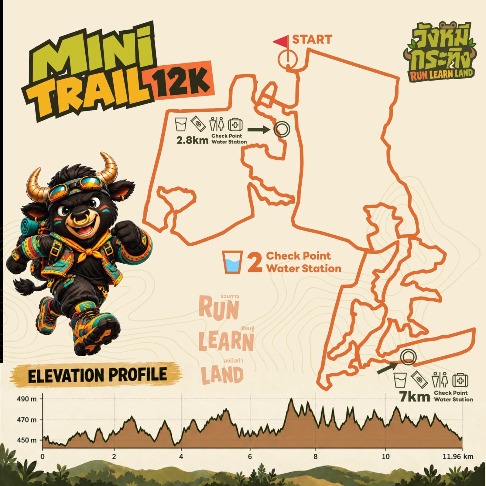
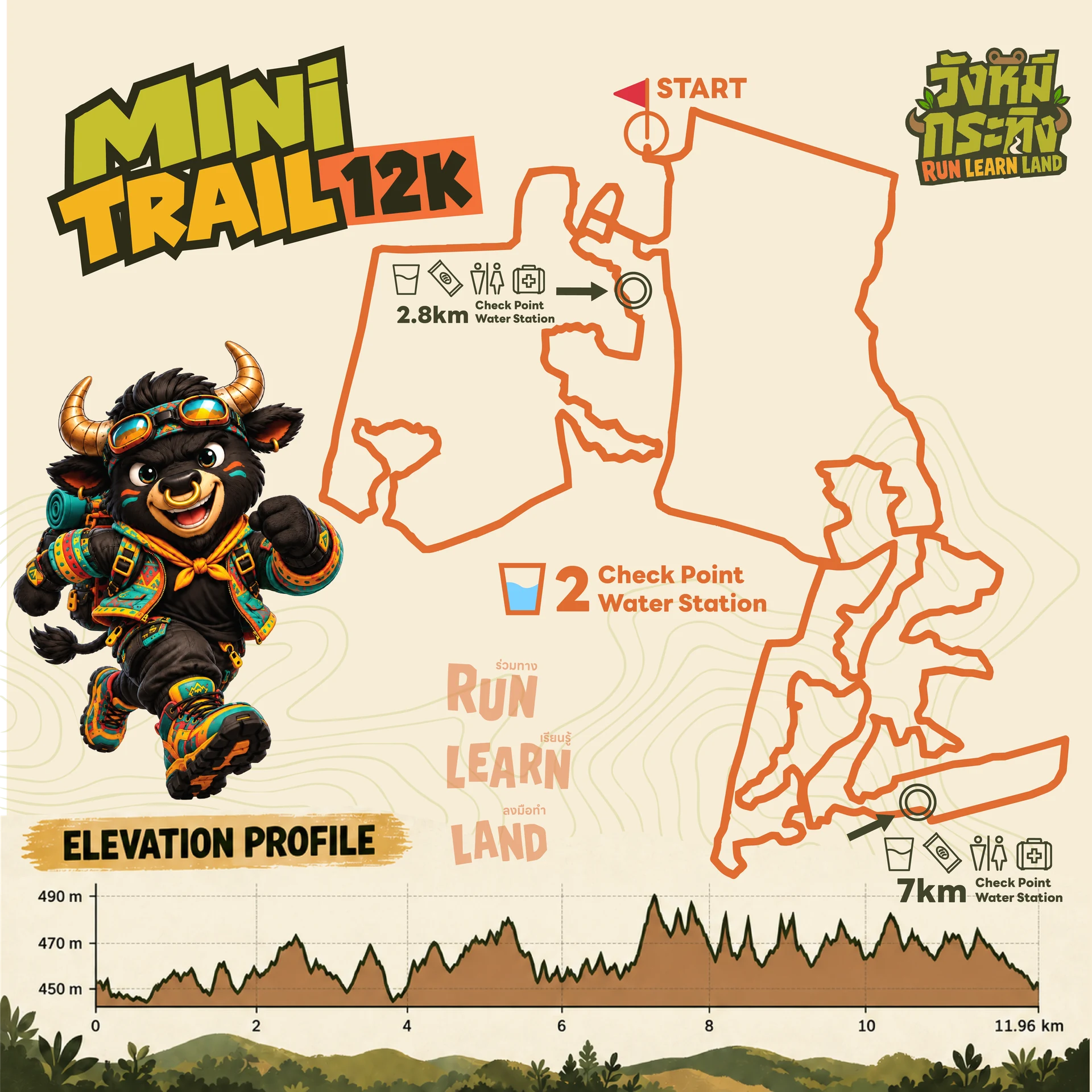
- Actual Distance
- 11.96 km
- Elevation Gain
- +388m
- Difficulty
- Moderate / Trail
- Water Stations
- 2 stations
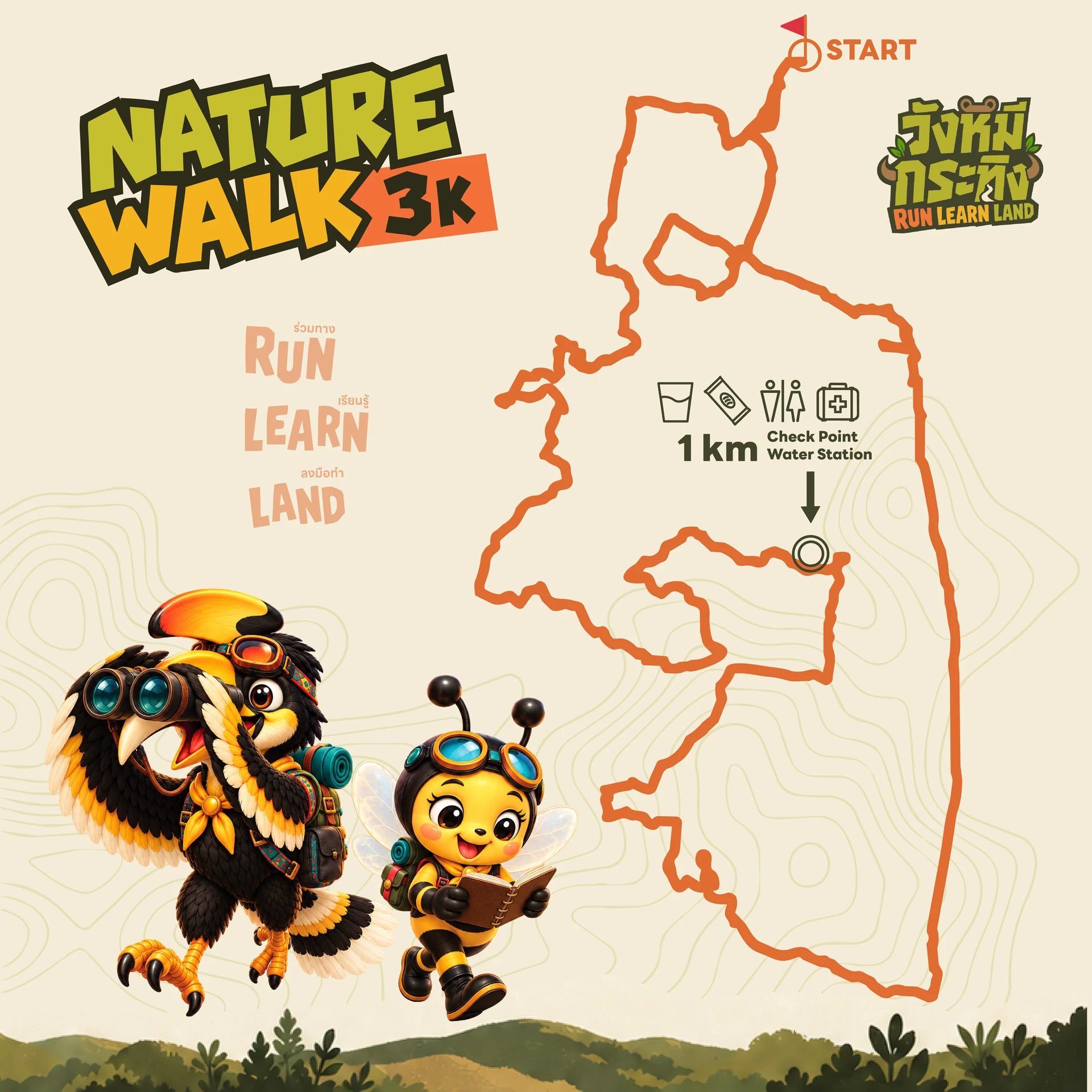
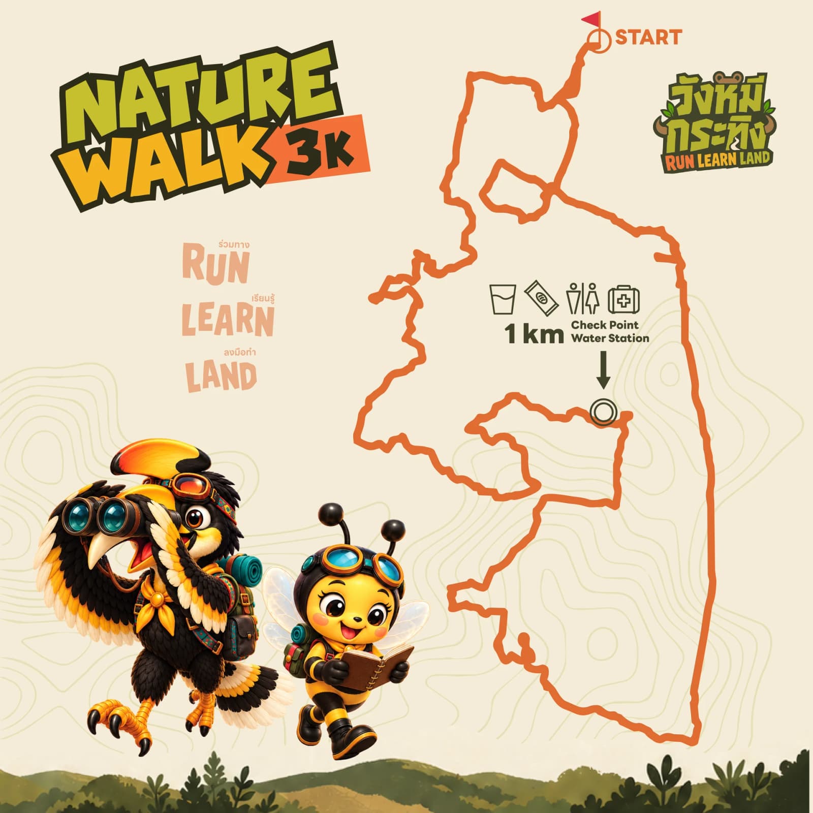 3 kmElevation —
Nature Walk 3K (guided nature walk)
Flat going along the edge of the community forest, orchards and organic plots. No slippery rock, so it suits small children and older walkers.
See this distanceService points (check points and water stations)
- WS1 at km 1.5 (water and electrolytes)
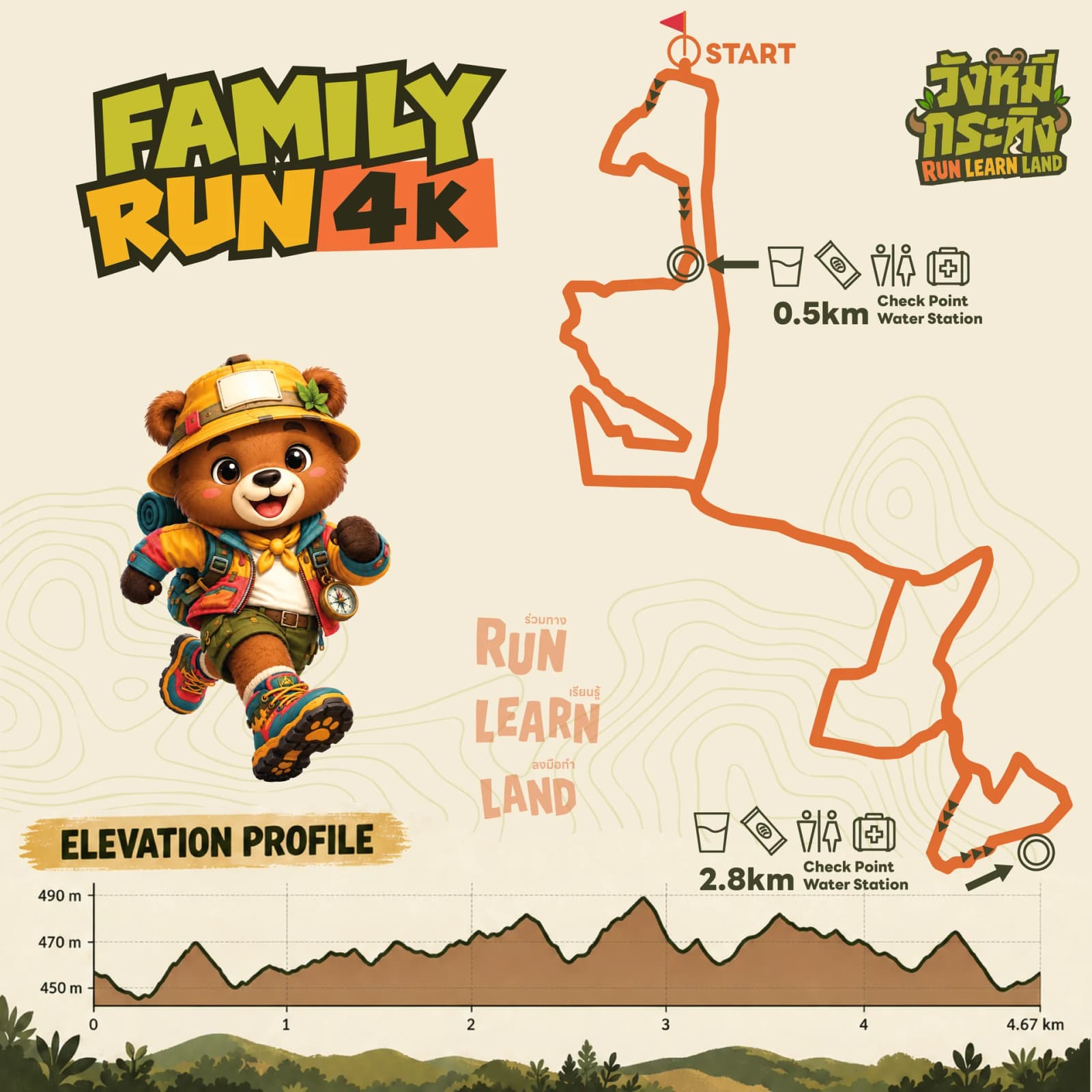 4 kmElevation +157m
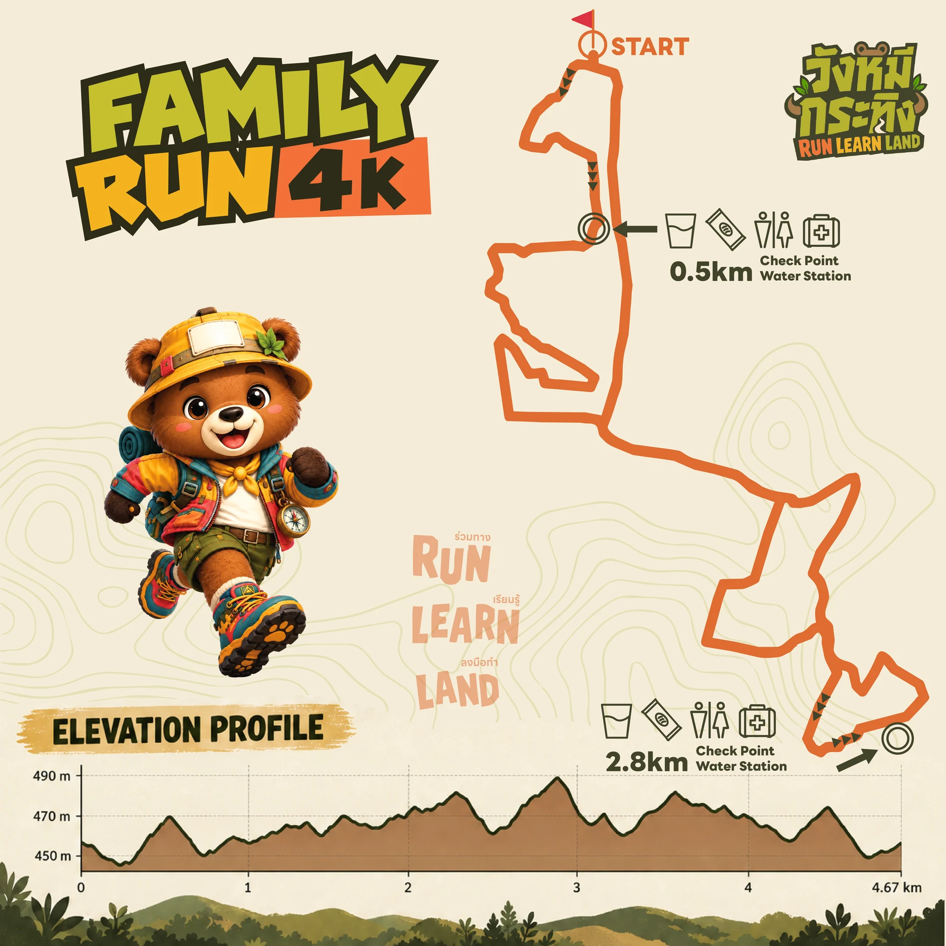
Family Run 4K (a fun run for families)
Gravel and packed earth through the natural grassland where the bulls graze, with gentle rises that add a little challenge.
See this distanceService points (check points and water stations)
- START/FINISH — toilets, water, snacks, electrolytes, first-aid point
- Check Point 1 · Giant Swing (at 0.5 km) — toilets, water, snacks
- Check Point 2 · Golden Hour Lawn (at 2.8 km) — water, snacks, electrolytes, first-aid point
- 12 kmElevation +388m
Mini Trail (the challenging natural route)
Genuine trail: rocky ridgelines, bamboo forest and steep pitches, with 360-degree views over the Dong Phaya Yen–Khao Yai range.
See this distanceService points (check points and water stations)
- START/FINISH — toilets, water, snacks, electrolytes, first-aid point
- Check Point 1 · Giant Swing (at 3.5 km) — toilets, water, snacks
- Check Point 2 · Golden Hour Lawn (at 7 km) — water, snacks, electrolytes, first-aid point
VENUE & MASTER PLAN
Venue plans — Wang Mi Krathing
Three aerial views of the event site at the Wang Mi Agricultural Wellness Learning Centre, Wang Nam Khiao — master plan · tent zone · family activity zone (swipe for the next one, or open an image full size).
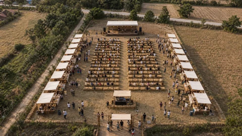 Master plan
Site master plan (main stage · hay seating · vendor tents)
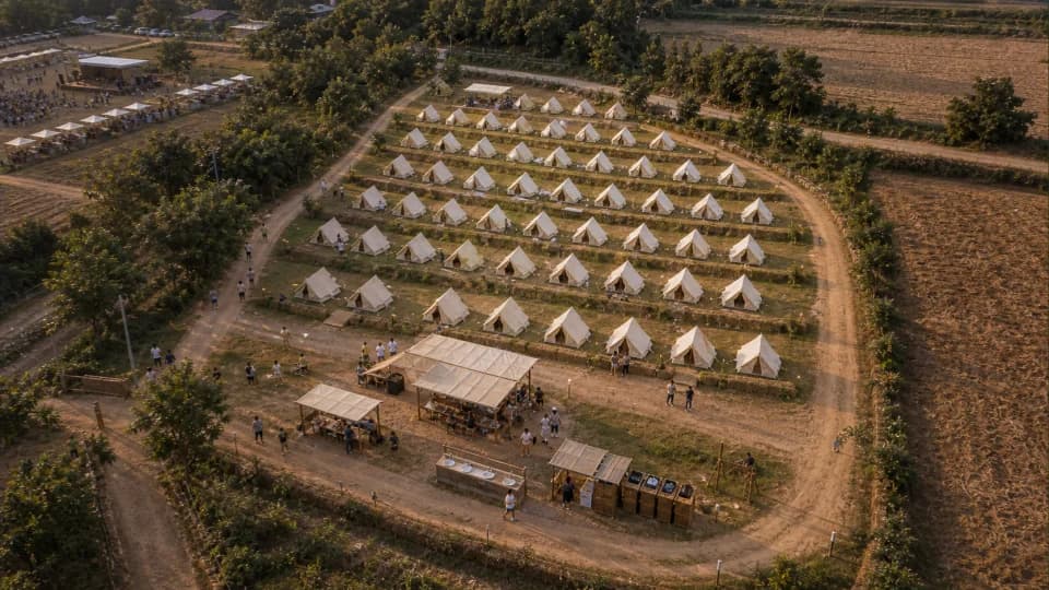 Tent zone
A-frame tent zone and service area
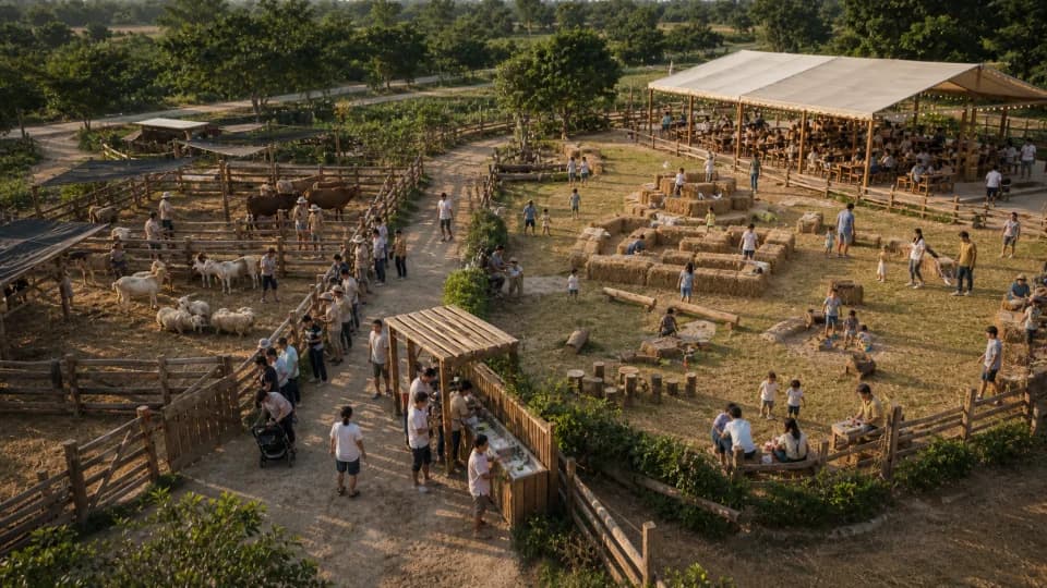 Activity zone
Family activity zone (animal pens · hay play · pavilion)
A run for farmers, supporting the Wang Nam Khiao agricultural learning centre
This Wang Nam Khiao trail run route passes through the Wang Mi farming community: community forest, orchards and organic farm plots. The run raises funds for an agricultural learning centre that supports farmers and the local community.